Justin Liles: More unseasonable warmth coming
Freezing drizzle and flurries are possible in the Arrowhead tonight before ending early Thursday morning south to north. Warm temperatures about five to ten degrees above normal Thursday further warm this weekend to be around fifteen degrees above normal. An isolated rain shower cannot be ruled out in northwest Wisconsin Friday.
If leaving or traveling Friday and Saturday, thick fog will likely be the biggest travel threat. There is a 60% chance of a wetting rainfall for most northeast Minnesota and northwest Wisconsin Sunday afternoon into Monday midday. Temperatures are going to be well above average over the holiday weekend. There is chance with the rain we see Sunday and Monday temperatures will be at or above 40°.
This will be one of the warmest Christmas days on record. Not only will our daytime highs flirt with record highs but our overnight lows will be some the highest we’ve ever had. There is a chance of some light snow up north Sunday night into Monday morning. We aren’t looking at much but it might be enough to coat the ground so this Christmas isn’t completely brown.
TONIGHT
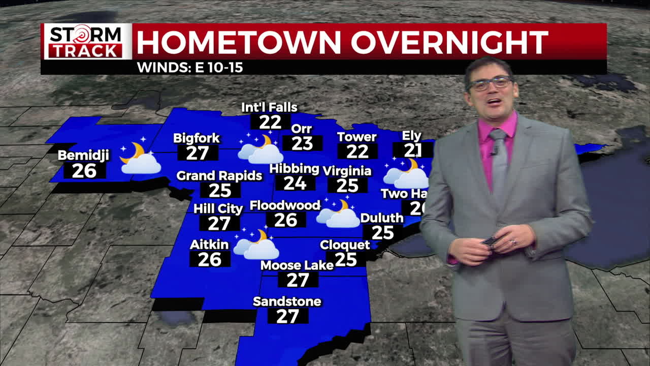
Mostly cloudy, with a low around 26. Breezy, with an east wind 10 to 15 mph, with gusts as high as 25 mph.
THURSDAY
Mostly cloudy, with a high near 36. Southeast wind 5 to 10 mph.
FRIDAY
A 20 percent chance of rain. Cloudy, with a high near 38. Southeast wind around 5 mph.
SATURDAY
Cloudy, with a high near 40. East wind around 5 mph.
SUNDAY
Rain likely, mainly after noon. Cloudy, with a high near 43. East wind around 10 mph, with gusts as high as 15 mph.
CHRISTMAS DAY
A chance of rain. Mostly cloudy, with a high near 40. Breezy, with a northeast wind around 15 mph, with gusts as high as 25 mph.
TUESDAY
A chance of rain. Mostly cloudy, with a high near 37. Breezy, with a northeast wind 10 to 15 mph, with gusts as high as 20 mph.