Storm summary for December 21-24

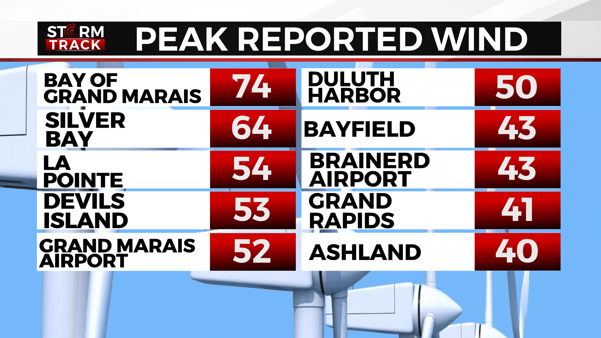
The Bay of Grand Marais had the strongest wind from this winter storm, with 74 mph reported.
A powerful, cross-country winter storm originated in the Pacific Northwest on December 20, 2022, bringing up to two feet of snow to the Cascades. As the storm tracked east, it brought high snowfall accumulations, bitter cold temperatures, and power outages along with it.
This winter storm underwent “bombogenesis,” becoming a bomb cyclone on December 23. For the Northland, the main issues from this storm were the winds. Gusty northwest winds caused blowing snow, decreasing visibility and creating poor road conditions during pre-holiday travel.
The wind also made wind chills drop to the -30s and caused all of Cook County to lose power. The highest winds (over 35 mph) reported to the National Weather Service are as follows:
- 10:26 am 12/23 – Bay of Grand Marais – 74 mph – Cook County
- 8:40 am 12/24 – 1 SSE Silver Bay – 64 mph – Lake County
- 4:45 am 12/24 – La Pointe – 54 mph – Ashland County
- 8:00 am 12/24 – Devils Island – 53 mph – Ashland County
- 5:35 pm 12/23 – Grand Marais Airport – 52 mph – Cook County
- 10:48 am 12/23 – Duluth Harbor – 50 mph – St. Louis County
- 3:30 pm 12/23 – Schroeder – 48 mph – Cook County
- 5:14 pm 12/23 – Duluth International Airport – 48 mph – St. Louis County
- 5:34 pm 12/23 – Chisholm-Hibbing Airport – 48 mph – St. Louis County
- 1:35 am 12/24 – Duluth Sky Harbor Airport – 47 mph – St. Louis County
- 5:35 pm 12/23 – Grand Portage – 47 mph – Cook County
- 1:40 am 12/24 – Saxon Harbor – 45 mph – Iron County
- 7:18 am 12/24 – 1 W Bayfield – 43 mph – Bayfield County
- 11:45 am 12/23 – Northome – 43 mph – Koochiching County
- 11:49 am 12/23 – Brainerd Airport – 43 mph – Crow Wing County
- 4:46 pm 12/23 – Hermantown – 42 mph – St. Louis County
- 9:59 pm 12/23 – Two Harbors – 42 mph – Lake County
- 8:33 pm 12/23 Grand Rapids Airport – 41 mph – Itasca County
- 8:04 qm 12/24 – Isabella – 40 mph – Lake County
- 5:46 am 12/24 – Ashland Airport – 40 mph – Ashland County
- 8:40 pm 12/23 – 1 N Port Wing – 40 mph – Bayfield County
- 6:24 pm 12/23 – Eveleth-Virginia Airport – 39 mph – St. Louis County
- 3:07 pm 12/23 – Hibbing – 38 mph – St. Louis County
- 7:15 pm 12/23 – Ely Airport – 38 mph – St. Louis County
- 1:02 am 12/24 – Washburn – 36 mph – Washburn County
- 1:35 am 12/24 – Superior Airport – 35 mph – Douglas County
The strong northwest winds also caused high accumulations of lake-effect snow for the South Shore. The following are local snowfall reports as reported to the National Weather Service:
- 7:00 am 12/24 – 2 WNW Ironwood – 19.6 inches – Gogebic County
- 7:00 am 12/24 – Gile – 15.5 inches – Iron County
- 7:00 am 12/24 – 8 N Mass City – 15 inches – Ontonagon County
- 7:00 am 12/24 – 1 ESE Bergland – 14.2 inches – Ontonagon County
- 8:45 pm 12/23 – 1 N Solon Springs – 3 inches – Douglas County
Wind speeds gradually decreased during the day Saturday. Meteorologist Sabrina Ullman says the South Shore will likely only have 3-6 inches of additional accumulation. As for blowing snow, there may still be a few spots with ¼ mile of visibility, but for the most part, driving should be fine.
The National Weather Service has replaced the Blizzard Warning for the Arrowhead and replaced it with a Winter Weather Advisory. There is still a Winter Weather Advisory for Iron County until 6 am Sunday. Other Winter Weather Advisories have been cancelled due to the improving conditions.
A Wind Chill Advisory remains in effect for all of the Northland, except Iron County, until 8 am Sunday. Afternoon highs for Christmas Day will be in the positive single digits, but a northwest wind of 5-15 mph will keep wind chill values in the -20s.
Updated weather alerts can always be found here.