Justin Liles: Rain, fog, and winds to continue
A large area of low pressure has slowed down and has parked itself right over western Minnesota. This slow-moving low is likely going to give us similar weather conditions over the a few days. Rain, fog, and windy conditions off the lake will continue to saturate our region. Many areas have picked up over 3 inches of rain. A flood warning remains in tack for southern St. Louis County until 7pm. As the low migrates east slowly, clouds will likely stick around once the rain wraps up.
Rain looks to linger into Tuesday morning, but the clouds may stick around until Wednesday and Thursday. Temperatures will likely stay in the lowers 60s all week with persistent lake winds. Some sun may return late in the week, but a chance of rain also returns late Friday into Saturday. There is another chance of rain is possible Saturday night.
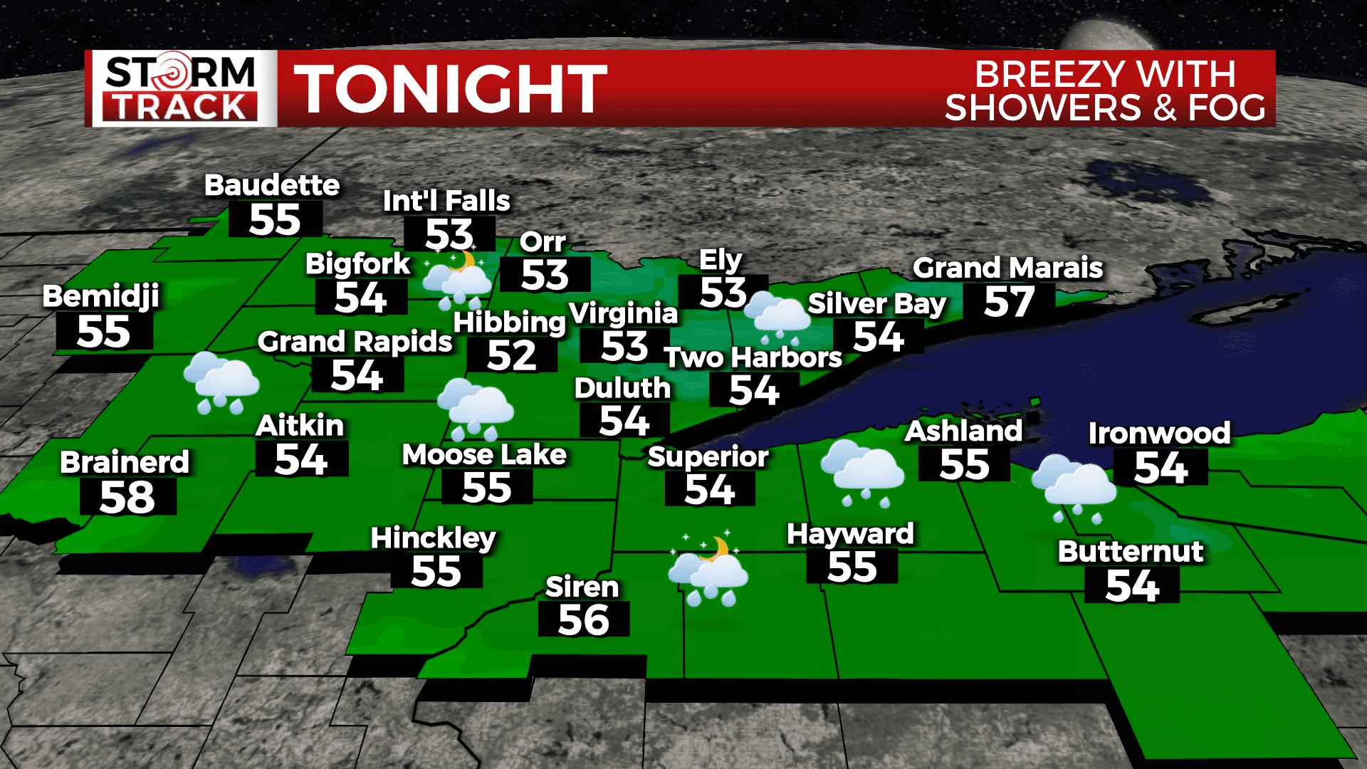
Tonight
More showers, fog and wind with a low around 55. Breezy, with an east wind around 15 mph, with gusts as high as 20 mph.
Monday
Still gloomy with showers, fog and wind and a High near 60. Breezy, with an east wind around 15 mph, with gusts as high as 25 mph.
Tuesday
A 20 percent chance of showers after 1pm. Partly sunny, with a high near 62. Breezy, with an east wind 15 to 20 mph, with gusts as high as 30 mph.
Wednesday
Mostly cloudy, with a high near 62. Breezy, with an east wind 10 to 15 mph, with gusts as high as 20 mph.
Thursday
Partly sunny, with a high near 65. Breezy, with a southeast wind 5 to 15 mph, with gusts as high as 20 mph.
Friday
A slight chance of showers. Partly sunny, with a high near 69. Breezy, with a south wind 10 to 15 mph, with gusts as high as 20 mph.
Saturday
A chance of showers. Partly sunny, with a high near 74. Breezy, with a south wind 10 to 15 mph, with gusts as high as 20 mph.