Justin Liles: Periods of rain showers possible
Our relatively drier landscape is not set to receive a lot of rain this week. We will have some widely scattered thunderstorms that could produce some gusty winds and some larger hail. However, our pattern is going to set up to be rather dry.
I guess at this point any rain is welcomed. This week will also be one of those warmer inland and cooler by the lake ordeals. Twenty degrees temperature differences between downtown and up on the hill will be a huge possibility all week. Our pattern this week will be one that sees daytime heating followed by some pop-up afternoon and evening storms. Otherwise most of the work week looks rather quiet.
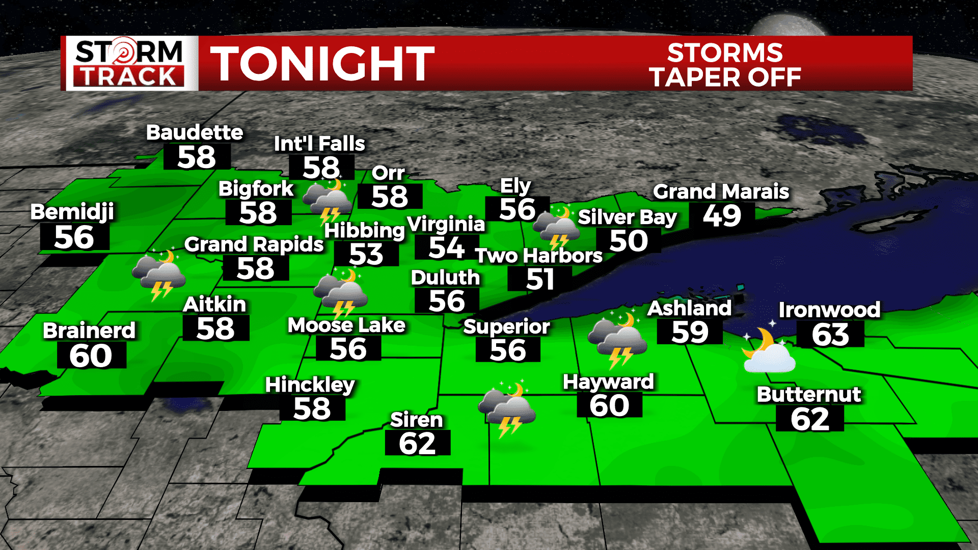
TONIGHT
Showers and thunderstorms likely, Mostly cloudy, with a low around 55. East wind 5 to 10 mph. Chance of precipitation is 60%.
WEDNESDAY
Scattered showers and thunderstorms, mainly after 4pm. Mostly sunny, with a high near 80. South wind 5 to 10 mph. Chance of precipitation is 30%.
THURSDAY
A 40 percent chance of showers and thunderstorms, mainly after 1pm. Mostly sunny, with a high near 74. East wind 5 to 10 mph, with gusts as high as 15 mph.
FRIDAY
A chance of showers and thunderstorms, mainly after 1pm. Mostly sunny, with a high near 74. East wind around 10 mph, with gusts as high as 15 mph.
SATURDAY
A slight chance of showers, then a chance of showers and thunderstorms after 1pm. Mostly sunny, with a high near 74. East wind 5 to 10 mph, with gusts as high as 15 mph.
SUNDAY
A chance of showers and thunderstorms. Mostly sunny, with a high near 76. East wind 5 to 10 mph, with gusts as high as 15 mph.
MONDAY
A slight chance of showers. Mostly sunny, with a high near 71. Breezy, with an east wind 10 to 15 mph, with gusts as high as 25 mph.
TUESDAY
Mostly sunny, with a high near 69. Breezy, with a northeast wind 10 to 15 mph, with gusts as high as 25 mph.