Justin Liles: A beautiful weekend coming!
The area of low pressure that has brought cooler than average temperatures and scattered rain showers will continue to shift to the east allowing a ridge of high pressure will build into the area from the west Saturday. This will cause chilly temperatures tonight and some patchy frost is possible for areas along and north of the Iron Range. Saturday will be warmer with plenty of sunshine with west winds of 10 to 15 mph and gusts up to 20 mph.
Sunday a weak piece of energy moves into the area, with cooler and more humid conditions around Lake Superior. Farther inland, temperatures will warm into the 70s. No precipitation chances are expected over the weekend. Thunderstorms look to return with unseasonably warm weather Tuesday. Some stronger storms will be possible along the International Border. Temperatures around the Northland with the exception of right by the lake will see temperatures climbing close to 80°.
TONIGHT
Mostly clear, with a low around 41. Northwest wind around 5 mph, with gusts as high as 15 mph.
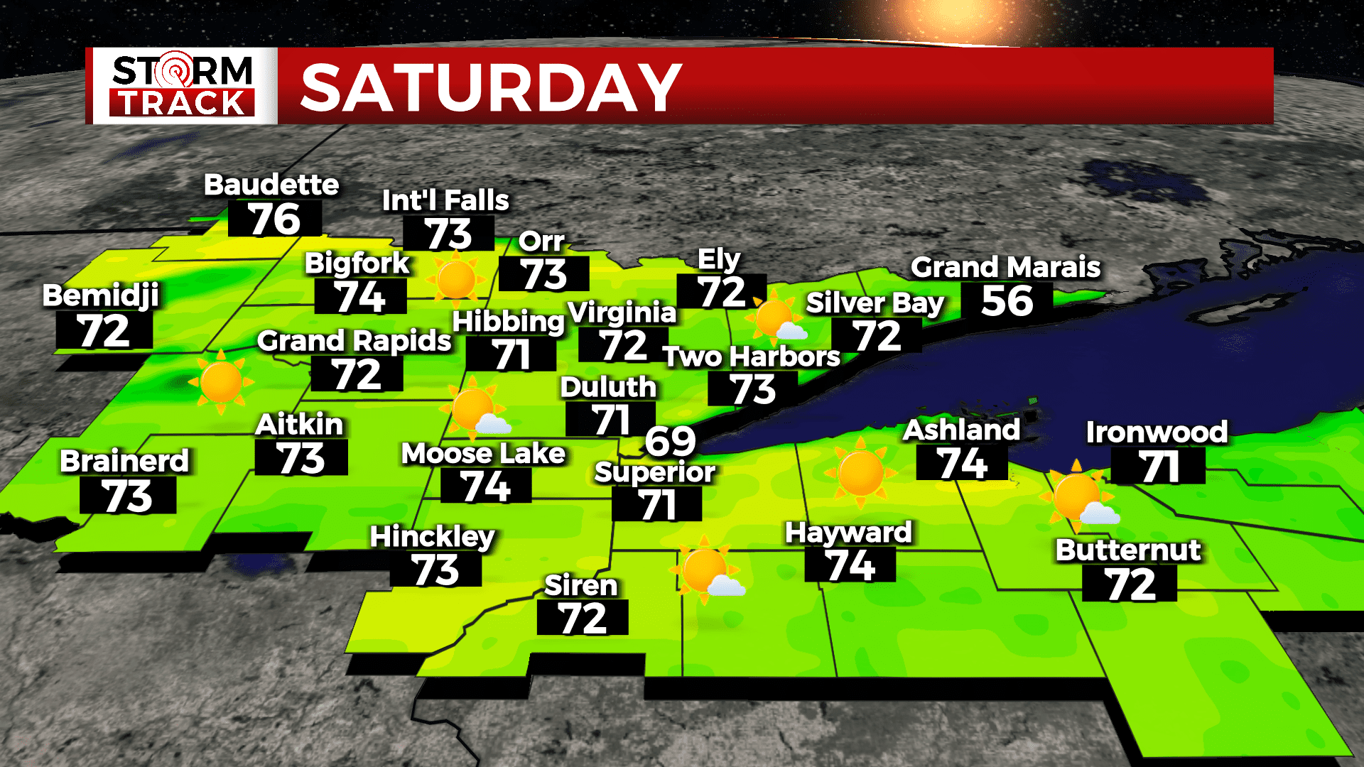
SATURDAY
Sunny, with a high near 70. West wind 5 to 10 mph, with gusts as high as 15 mph.
SUNDAY
Sunny, with a high near 61. Breezy, with a northwest wind 5 to 10 mph becoming east 15 to 20 mph in the afternoon. Winds could gust as high as 25 mph.
MONDAY
Mostly sunny, with a high near 69. Southeast wind around 10 mph, with gusts as high as 15 mph.
TUESDAY
A slight chance of showers and thunderstorms after 1pm. Mostly sunny, with a high near 79. Breezy, with a southwest wind around 15 mph, with gusts as high as 25 mph.
WEDNESDAY
A slight chance of showers. Partly sunny, with a high near 60. Breezy, with an east wind around 15 mph, with gusts as high as 25 mph.
THURSDAY
A slight chance of showers. Mostly sunny, with a high near 69. Breezy, with a southeast wind 10 to 15 mph, with gusts as high as 20 mph.