Weatherz School: Chinook winds

A process that can cause rain on the windward side of a mountain and warmer and drier conditions on the leeward side.
When it comes to terrain, the Northland certainly isn’t the Rocky Mountains. However, we do have enough peaks for the terrain to affect our weather. Let’s start with a terrain induced phenomenon often talked about in other parts of the U.S.; Chinook winds.
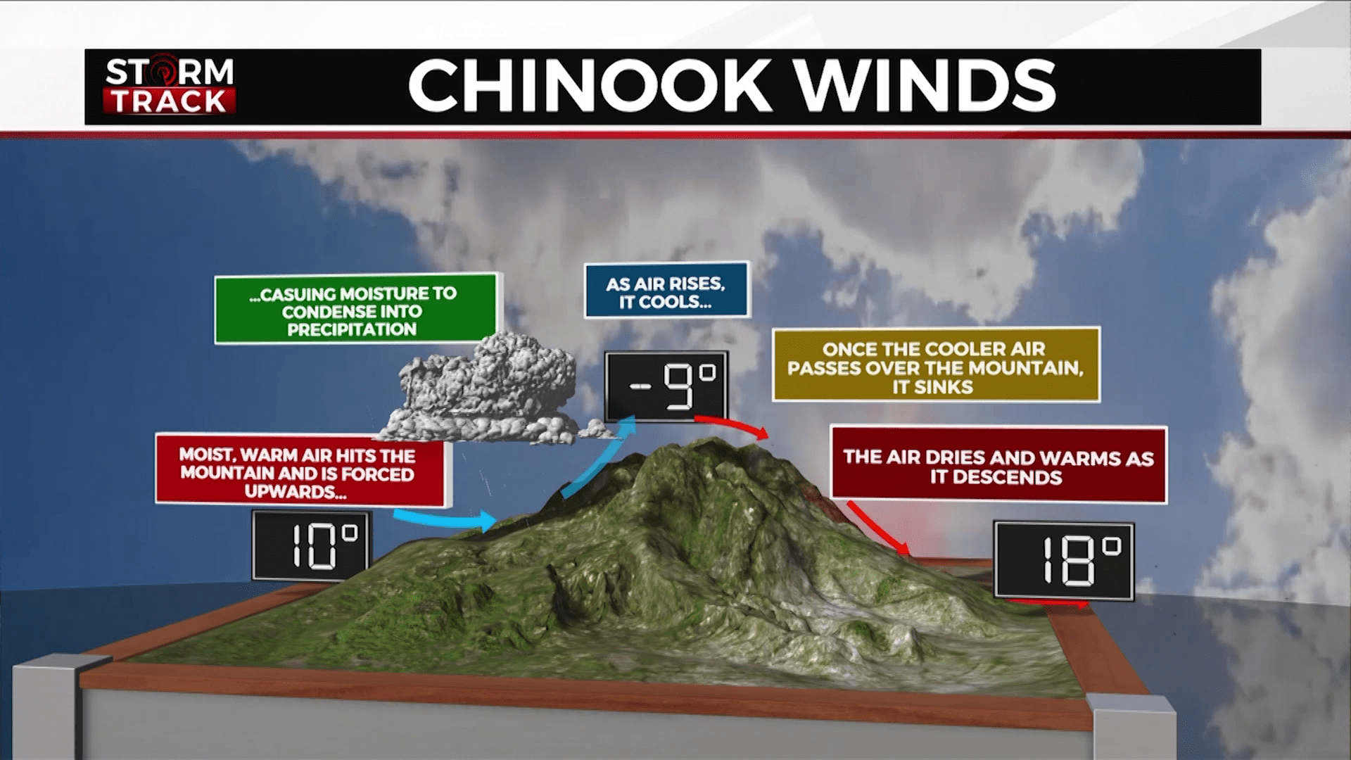
Chinook winds begin with warm, moist air hitting the mountains and being forced upwards, causing moisture to condense into precipitation. As air rises, it cools. Once the cooler air pass over the mountain, it sinks.
The air dries and warms as it descends. As a result, the air on the leeward slopes is warmer than on the windward slopes. The descending air warms at the dry adiabatic lapse rate, which is a temperature change of about 5.5 °F for every 1,000 ft.
The term “Chinook” originated along the Pacific Northwest coast to describe warm winds moving in from the ocean. It was named for the people indigenous to that region. The phrase has become common across the Rocky Mountains pronounced as “Shi-Nuk” to describe downslope warming caused by prevailing westerly winds, but the same process can happen anywhere with enough of a change in elevation.
The greatest elevation change in Minnesota is across the North Shore. Eagle Mountain, the highest point in the state, is 2,301 ft above sea level. Mere miles away, Lake Superior has an elevation around 600 ft. Keeping in mind the dry adiabatic lapse rate, a north northwest wind over this change in elevation can cause warming of around 9 °F.
The elevation change in the Twin Ports isn’t as impressive as it is in Grand Marais, but it still affects our temperatures. The official Duluth temperature is recorded at the Duluth International Airport at an elevation of 1428 ft.
The “by the Lake” temp we talk about is at the Sky Harbor Airport at 610 ft. A northwest wind here can cause warming of around 4 °F. This is important because the notion that it’s always cooler by Lake Superior is a myth.
On a hot summer day, a gentle east wind can keep the temperature by Lake Superior a good 30 degrees below the temp on the hill. However, if that wind shifts out of the west, downslope warming can push the Sky Harbor Airport even further into the 90s than Duluth International.