Breaking down our warm and snowless winter

December through February was consistently warm and snowless
The talk of the season has been how warm and snowless it’s been. Now that we’re into March, we can look back on how our temperatures, precipitation, and snowfall measured up compared to average. Meteorological winter is defined as December, January, and February.
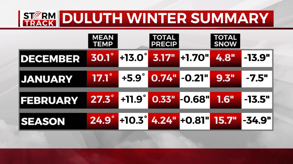
December in Duluth was the second warmest on record, only being beaten by 1877-1878 when weather observations were taken at lower elevation and closer to Lake Superior than the current observations. It was also very wet.
December brought enough rain to make up for the precipitation deficits of January and February and bring the season total precip above normal by 0.81″.
January featured a cold snap that accounted for 9 of only 11 days in the season with a subzero low temperature. Even so, warm stretches at the beginning and end of the month still brought the mean average monthly temperature 5.9° above normal.
January was also the snowiest month of the season, which isn’t saying much. It was still short of normal monthly snowfall by 7.5″.
February kept both the warm and snowless trends going strong. The month was 11.9° above normal, which is the 4th warmest on record in Duluth. The measly 1.6″ of snowfall set a new monthly record for least snowy February. The previous record was 2.1″ in 1896.
In total, the season had a mean average temperature of 24.9°. This was 10.3° above normal, and as was the case in December, is second only to 1877-1878.
Total snowfall of 15.7″ was 34.9″ below normal. This isn’t a record for December through February, but we also had a rather snowless fall.
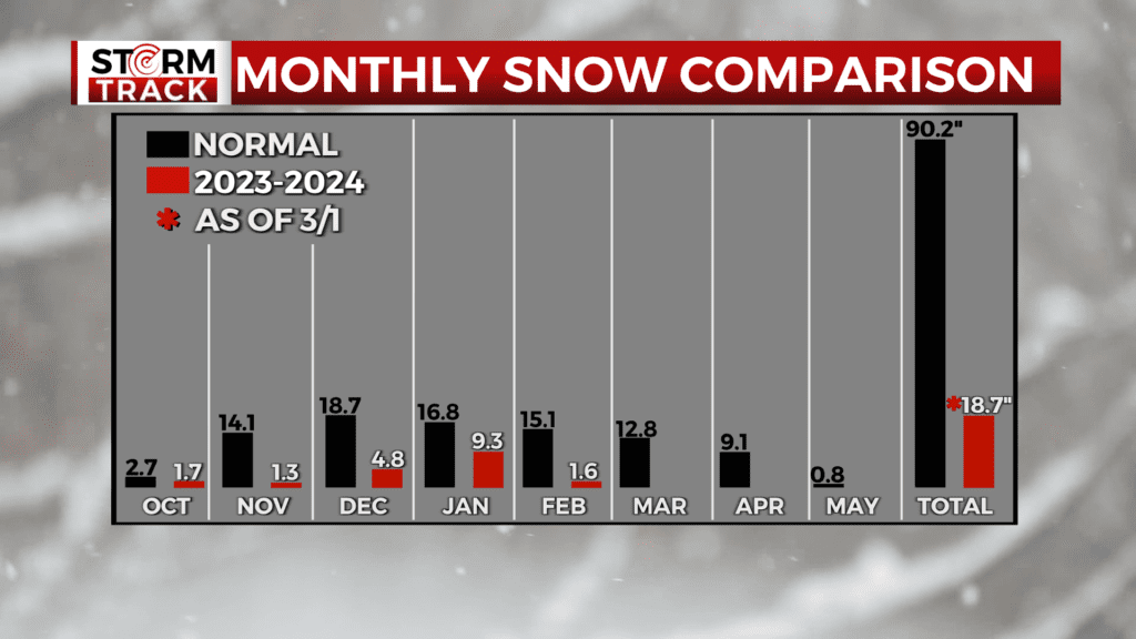
As of March 1st, Duluth only has 18.7″ to show for the season. Even if we maintained normal snowfall for the spring, our season total of 41.4″ would be nearly 50″ below normal.
The current record for least snowy season is 36.5″ in 1980-1981. That means Duluth could pick up 17.7″ and still secure the record this year.
Keep in mind, this is on the heels of Duluth’s snowiest season on record with 2022-2023 topping off at 140.1″.