Spring snow: What you need to know Tuesday
The messy spring storm has arrived and will continue impacting the Midwest through Tuesday. Accumulating snow, wintry mix, rain, and strong winds will affect the area.
Adverse travel conditions are unfolding. Ice accumulated in parts of the North Shore, east central Minnesota, and northwest Wisconsin Tuesday morning. This has been followed by additional snow accumulation as snow became the dominant precipitation type once more from the west through the morning Tuesday.
Tuesday’s travel is the worst through the morning into the afternoon. Snowfall rates lighten up in the late afternoon and evening with snow retreating north toward the Canadian border. Additional accumulation after 7 pm Tuesday will be minimal, allowing travel conditions to improve Tuesday night and Wednesday.
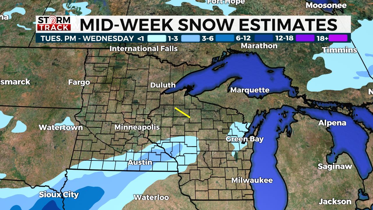
Click here for potential snowfall amounts.
WHAT YOU CAN DO
- Monitor the forecast for updates on WDIO.com and on the WDIO mobile app.
- Stay aware for possible travel impacts and road conditions
- If traveling, call ahead to your destination and bring your winter weather gear, warm clothes, flashlight, snacks, shovel.
- When outside shoveling, dress for the conditions. Take breaks and drink plenty of water. If you are able, help a neighbor.
Follow the WDIO Storm Track Weather Team with Chief Meteorologist Justin Liles, GMN Meteorologist Brandon Weatherz, and Weekend Meteorologist Sabrina Ullman.