Justin Liles: The snow is finally coming!
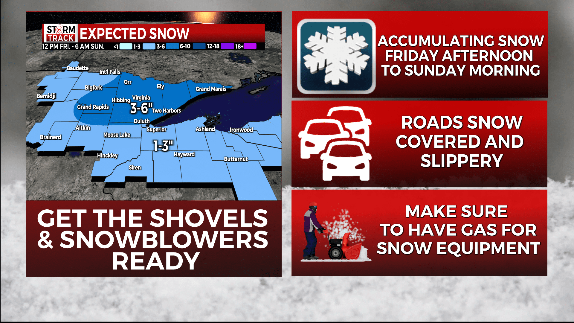
Do you have your shovels and snow blowers ready to go? Temperatures will fall into the teens tonight with light south winds. Snow flurries possible early. A steady light to moderate snow is expected starting late Friday afternoon and lasting through Sunday, except occasionally heavy along the North Shore.
Total accumulations from 2 to 5 inches for most places, a little less in northwest Wisconsin, and locally higher along the North Shore with totals up to 7 inches. Road conditions will likely deteriorate as we head into the afternoon and evening hours Friday into Saturday morning. Once the wind shifts to the northwest on Sunday, we’ll likely see snow shift to the south shore and the U.P. of Michigan.
TONIGHT
Mostly cloudy, with a low around 17. Southwest wind around 10 mph, with gusts as high as 20 mph.
FRIDAY
Snow, mainly after 4pm. High near 29. Southwest wind 5 to 10 mph becoming southeast in the afternoon. Winds could gust as high as 15 mph.
SATURDAY
Snow. High near 32. South wind 5 to 10 mph becoming southwest in the afternoon.
SUNDAY
A slight chance of snow before noon. Partly sunny, with a high near 24. Blustery, with a northwest wind 10 to 15 mph, with gusts as high as 20 mph.
MONDAY
A slight chance of snow after noon. Mostly cloudy, with a high near 25. Northeast wind 5 to 10 mph becoming southeast in the afternoon. Winds could gust as high as 15 mph.
TUESDAY
A slight chance of snow. Mostly cloudy, with a high near 27. Northeast wind 5 to 10 mph.
WEDNESDAY
A slight chance of snow. Mostly cloudy, with a high near 24. Northwest wind around 10 mph, with gusts as high as 20 mph.
THURSDAY
A chance of snow. Mostly cloudy, with a high near 19. Blustery, with a north wind 10 to 15 mph, with gusts as high as 25 mph.