Justin Liles: Rain showers begin tonight, cooler this weekend.
[anvplayer video=”5189839″ station=”998130″]
Showers and thunderstorms are expected for most areas tonight in advance of a cold front that is expected to pass through on Friday morning. Areas in northeast Minnesota are most likely to see around or slightly above a quarter inch of rain, with some locally higher amounts not out of the question from storms. Lower amounts are expected in northwest Wisconsin.
Winds are expected to become west to northwesterly Friday afternoon around 10 to 15 mph with some higher gusts to around 20 mph. Slightly cooler temperatures are expected over the weekend. Winds will shift to northeasterly by Saturday, then southerly on Sunday. Additional rain chances are possible Sunday night into Monday.
TONIGHT
A 20 percent chance of showers and thunderstorms after 4am. Patchy fog after midnight. Otherwise, increasing clouds, with a low around 63. Northeast wind around 5 mph becoming west after midnight.
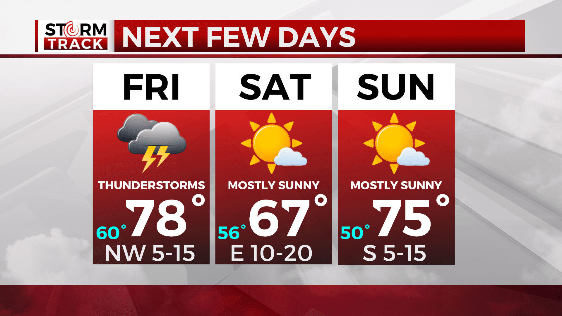
FRIDAY
A 40 percent chance of showers and thunderstorms, mainly before 11am. Patchy fog before 9am. Otherwise, mostly cloudy, then gradually becoming sunny, with a high near 80. Breezy, with a northwest wind 5 to 15 mph, with gusts as high as 20 mph.
SATURDAY
Mostly cloudy, then gradually becoming sunny, with a high near 65. East wind around 10 mph, with gusts as high as 15 mph.
SUNDAY
Mostly sunny, with a high near 74. South wind 5 to 10 mph.
MONDAY
A slight chance of showers, then a chance of showers and thunderstorms after 1pm. Mostly sunny, with a high near 72. Breezy, with a northwest wind 10 to 15 mph, with gusts as high as 20 mph.
TUESDAY
Mostly sunny, with a high near 69. Breezy, with a northwest wind 10 to 15 mph, with gusts as high as 20 mph.
WEDNESDAY
Sunny, with a high near 71. East wind around 10 mph, with gusts as high as 15 mph.
THURSDAY
Sunny, with a high near 76. Breezy, with a southeast wind 10 to 15 mph, with gusts as high as 20 mph.