Justin Liles: Cold lake breeze and wet this weekend
A long period of easterly winds off Lake Superior will occur keeping temperatures cooler than communities further inland. There may be a few showers over the eastern half of the Northland on Friday with better chances for rain and a few thunderstorms developing over the weekend. Several pieces of energy will roll through the weekend and into next week.
Heavy rain showers will likely develop tomorrow night for our southern viewing area. Most of the rain will fall after midnight into Saturday. Rain will likely spread northward Saturday night into Sunday and keep the Northland winds. Wet weather continues Monday and Tuesday along with breezy conditions. It does look like warmer weather is likely along with better skies toward the end of next week and the start of the Minnesota Fishing Season.
TONIGHT
Increasing clouds, with a low around 38. Breezy, with an east wind around 15 mph, with gusts as high as 20 mph.
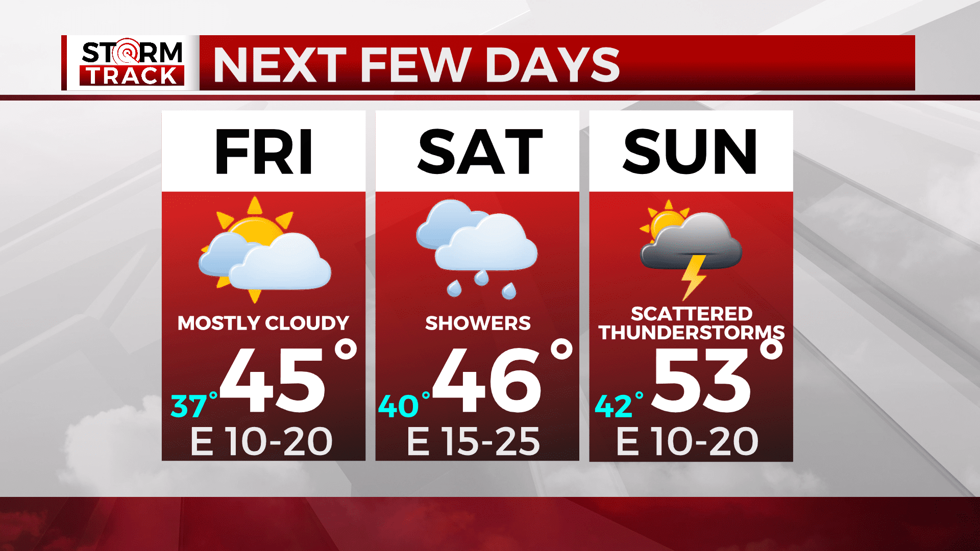
FRIDAY
Patchy fog before 9am. Otherwise, mostly cloudy, with a high near 51. Breezy, with an east wind 10 to 15 mph, with gusts as high as 30 mph.
SATURDAY
Showers likely, mainly after 1pm. Patchy fog before 10am. Otherwise, cloudy, with a high near 48. Breezy, with an east wind around 20 mph, with gusts as high as 30 mph.
SUNDAY
Showers likely, mainly after 1pm. Mostly cloudy, with a high near 54. Breezy, with an east wind around 15 mph, with gusts as high as 25 mph.
MONDAY
A chance of showers, mainly after 1pm. Mostly cloudy, with a high near 56. Breezy, with an east wind 10 to 15 mph, with gusts as high as 20 mph.
TUESDAY
A chance of showers. Mostly sunny, with a high near 61. Breezy, with a northeast wind around 15 mph, with gusts as high as 20 mph.
WEDNESDAY
A slight chance of showers. Partly sunny, with a high near 64. Breezy, with an east wind 10 to 15 mph, with gusts as high as 20 mph.