Rapid snowmelt brings stark contrast within one month
Our historic snow pack is quickly fleeting. For those keeping track, it’s been the third snowiest season on record in Duluth. As of April 13th, the season total snowfall is 131.7″, only 0.1″ away from second place set in the winter of 1949-1950.
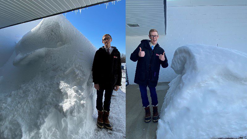
To help us wrap our minds around just how much snow has melted recently, we’re comparing photos of meteorologist Brandon Weatherz in front of WDIO from March 13th to April 13th.
In mid-March, our sidewalk was lined by snow banks several feet high, with the peak by our front door making 6’6″ tall Brandon look short. That snow pack held close to 10” of water.
Two weeks later, that tall peak had fallen to about 5 feet, but the general snow pack remained considerable.
As late as April 6th, the National Weather Service in Duluth still reported a snow depth of 30” with 8.5” of liquid equivalent. According to the NWS, April snow depth has only been greater than 30″ four other times since 1948.
By April 13th, a stretch of warm and sunny weather has drastically reduced the snow pack with little remaining in Duluth. This gives us an idea of just how much snowmelt has been running into the sewers and rivers, fueling our flooding concerns.