Sabrina Ullman: Multiple chances of snow this week.
[anvplayer video=”5147594″ station=”998130″]
After a brief break from precipitation, snow chances return late tonight. Light snow will move in from the west, becoming widespread Monday morning. We could see moderate snowfall towards Pine, Burnett, and Washburn counties in the afternoon, but this round will stay light otherwise. That said, the snowfall will be persistent, lasting through the day Monday and into Tuesday.
Areas along the North Shore will have lake-effect snowfall, resulting in more accumulation. The National Weather Service has issued a Winter Weather Advisory for Lake and Cook counties, in effect from 4 am Monday to 6 pm Tuesday. The latest road conditions, live traffic cameras, and an interactive radar can be found at WDIO.com/weather.
Another round of snow is likely Wednesday night.
Tonight
A chance of flurries before 8pm, then a chance of snow after 4am. Cloudy, with a low around 17. Calm wind becoming east around 5 mph. Chance of precipitation is 30%.
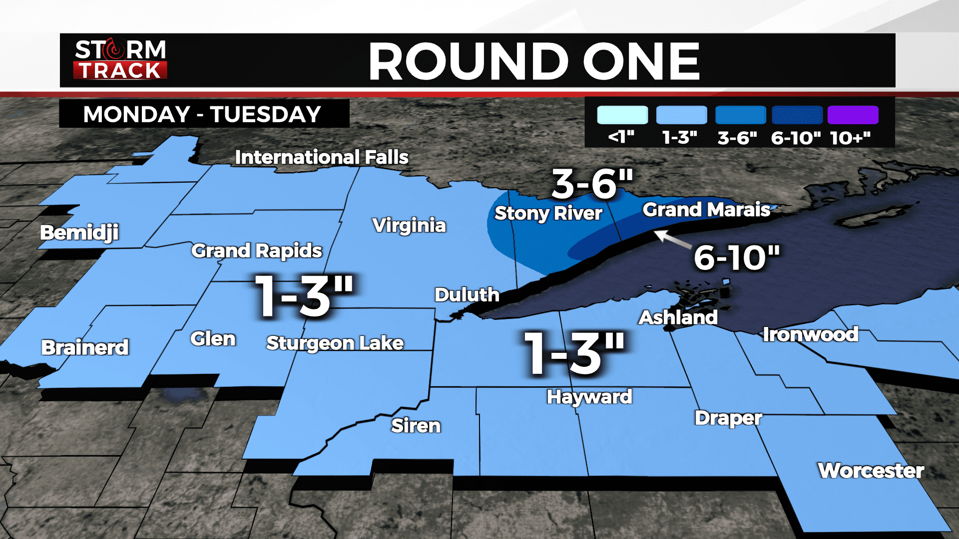
Snow will enter the region late Sunday night, becoming widespread Monday.
Monday
Snow likely, mainly after 7am. Cloudy, with a high near 30. Southeast wind 5 to 10 mph. Chance of precipitation is 70%. New snow accumulation of 1 to 2 inches possible.
Tuesday
Snow likely, mainly after 1pm. Cloudy, with a high near 32. East wind around 5 mph. Chance of precipitation is 60%. New snow accumulation of less than one inch possible.
Wednesday
A chance of snow, mainly after 1pm. Mostly cloudy, with a high near 31. North wind 5 to 10 mph.
Thursday
A chance of snow. Mostly cloudy, with a high near 27. Blustery, with a northwest wind 10 to 15 mph.
Friday
Mostly cloudy, with a high near 24. Breezy, with a west wind 10 to 15 mph, with gusts as high as 20 mph.
Saturday
Mostly cloudy, with a high near 20. Breezy, with a west wind 10 to 15 mph, with gusts as high as 25 mph.