Justin Liles: Winter Storm Warning
[anvplayer video=”5150133″ station=”998130″]
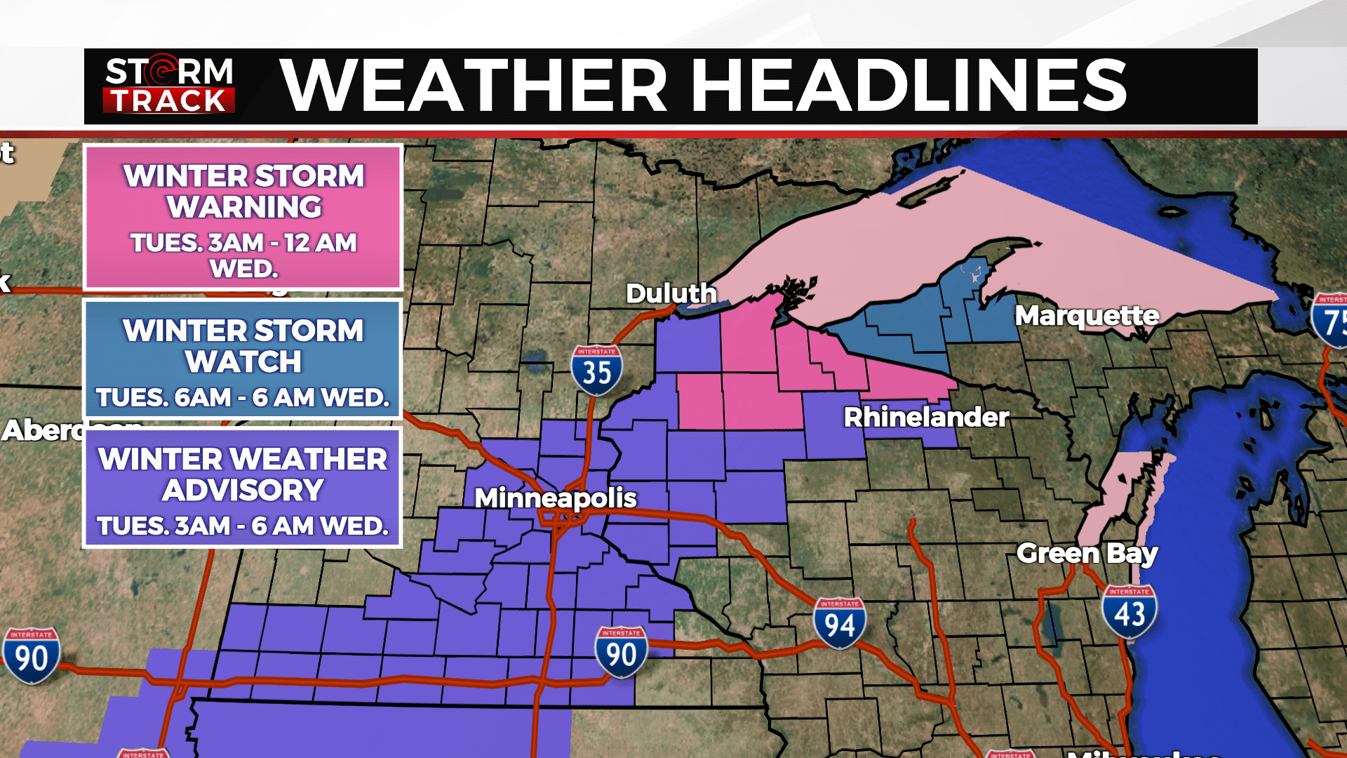
A quick burst of snow has worked through northeastern Minnesota this afternoon. This snow is likely to diminish overnight. Some lingering light flurries are still possible. A large low will pass to the south and create wintry conditions mostly south and east of the Twin Ports. The snow is expected to develop Tuesday morning and end or diminish in intensity Tuesday night.
Some lake effect snow showers may linger into Wednesday along the South Shore snow belts. A Winter Storm Warning is now in effect. Winds will pick up Wednesday will likely be quite chilly. Light flurries are possible Wednesday and then again Friday. Cold chilly air returns by the end of the week and into the weekend.
TONIGHT
A 30 percent chance of snow, mainly after 5am. Mostly cloudy, with a low around 25. Southeast wind around 5 mph becoming west after midnight. Winds could gust as high as 15 mph.
TUESDAY
Snow likely, mainly before 4pm. Cloudy, with a high near 28. Northwest wind 5 to 10 mph, with gusts as high as 20 mph. New snow accumulation of 1 to 2 inches possible.
WEDNESDAY
A chance of flurries. Partly sunny, with a high near 22. Windy, with a west wind 20 to 25 mph, with gusts as high as 35 mph.
THURSDAY
Partly sunny, with a high near 26. West wind 5 to 10 mph becoming south in the afternoon. Winds could gust as high as 20 mph.
FRIDAY
A slight chance of snow after noon. Mostly cloudy, with a high near 35. South wind 5 to 10 mph becoming west in the afternoon.
SATURDAY
Mostly sunny, with a high near 20. Blustery, with a northwest wind 10 to 15 mph, with gusts as high as 25 mph.
SUNDAY
A slight chance of snow. Mostly sunny, with a high near 27. Southwest wind around 10 mph, with gusts as high as 20 mph.
MONDAY
A slight chance of snow. Partly sunny, with a high near 21. Northwest wind around 10 mph, with gusts as high as 15 mph.