Justin Liles: Smoke sticking around, heat this weekend!
Northwesterly flow has taken over and is bringing smoke back into Minnesota from Canadian wildfires. This irritation is likely going to stick with us through Friday for Minnesota and Wisconsin. Winds will eventually shift to the south midday Saturday and begin clearing out the air. Then the heat and humidity are set to return.
Many parts of the Northland may see record breaking heat as temperatures rise into the upper 80s and low 90s. Conditions in central to southern Minnesota and Wisconsin will likely see heat advisories or warnings. This heat plans to stick around through much of next week too. The only saving grace is there will be a lake breeze on tap beginning Sunday. This should keep shoreline communities much cooler. Stay cool and stay safe as we head into a very hot weekend. Please don’t leave any pets or people in the cars.
TONIGHT
Widespread haze. Mostly clear, with a low around 51. Breezy, with a west wind 5 to 15 mph, with gusts as high as 20 mph.
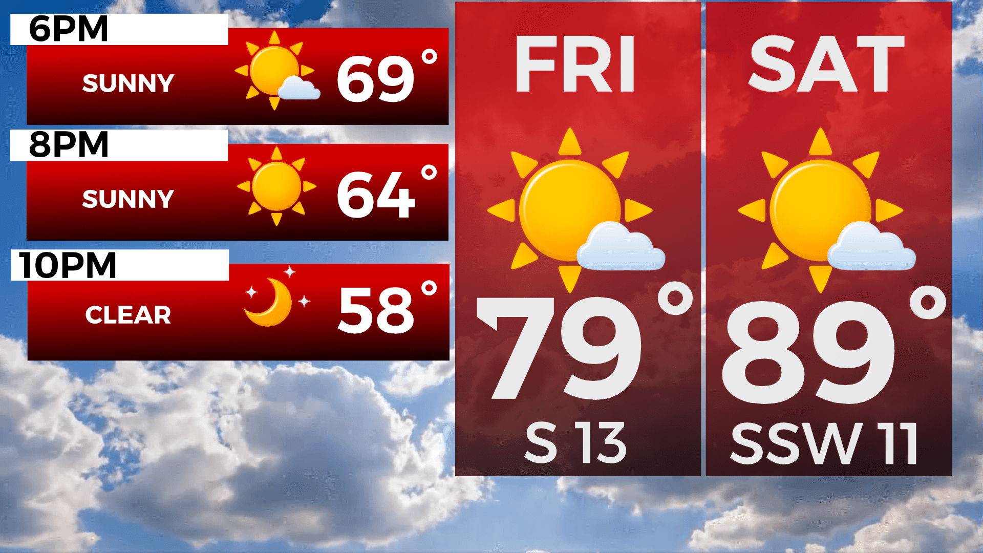
FRIDAY
Widespread haze after 5pm. Areas of smoke. Sunny, with a high near 78. Breezy, with a south wind 5 to 15 mph, with gusts as high as 20 mph.
SATURDAY
Sunny, with a high near 88. South wind around 10 mph, with gusts as high as 20 mph.
SUNDAY
Mostly sunny, with a high near 81. North wind around 10 mph, with gusts as high as 15 mph.
MONDAY
Partly sunny, with a high near 79. Breezy, with an east wind 10 to 15 mph, with gusts as high as 25 mph.
TUESDAY
Mostly sunny, with a high near 79. Breezy, with an east wind around 15 mph, with gusts as high as 25 mph.
WEDNESDAY
Mostly sunny, with a high near 80. East wind around 10 mph, with gusts as high as 15 mph.