Justin Liles: Mild weather continues
[anvplayer video=”5156462″ station=”998130″]
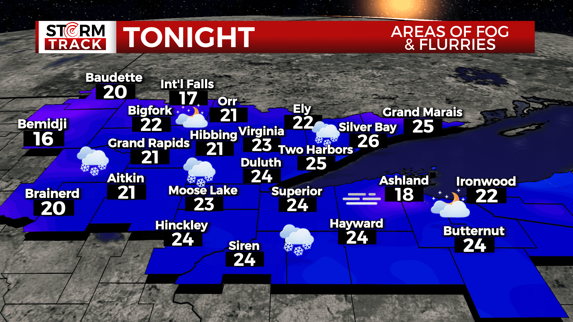
Areas of freezing fog and freezing drizzle will be possible tonight, especially along the North and South Shores. Freezing drizzle remains possible through Tuesday along the North Shore with snow moving in for Tuesday night and Wednesday.
Snow accumulations of an inch or two will be possible with isolated higher amounts. The best locations for the higher amounts of snow will be the higher terrain of the North Shore. Slick commutes will be possible, especially on Wednesday morning. As of now, there are no advisories or warnings.
Tonight
A slight chance of freezing drizzle before 2am, then a slight chance of snow between 2am and 5am, then a slight chance of freezing drizzle after 5am. Patchy fog before 7pm, then patchy fog after 8pm. Otherwise, cloudy, with a low around 23. East wind 5 to 10 mph, with gusts as high as 20 mph.
Tuesday
A slight chance of freezing drizzle before noon. Patchy fog before 10am. Otherwise, cloudy, with a high near 30. East wind around 5 mph.
Wednesday
A 40 percent chance of snow before noon. Mostly cloudy, with a high near 30. East wind around 5 mph becoming west in the morning.
Thursday
A 20 percent chance of snow before noon. Mostly cloudy, with a high near 26. Northwest wind around 10 mph, with gusts as high as 20 mph.
Friday
Mostly sunny, with a high near 22. Northwest wind 5 to 10 mph becoming west in the afternoon. Winds could gust as high as 15 mph.
Saturday
Mostly cloudy, with a high near 25. Southwest wind around 5 mph becoming southeast in the afternoon.
Sunday
Mostly cloudy, with a high near 31. Southeast wind around 10 mph, with gusts as high as 20 mph.