Justin Liles: Light snow on the way
[anvplayer video=”5161751″ station=”998130″]
High pressure is under control today and we saw plenty of sunshine. Temperatures all over were in the upper 30s to lower 40s. This is the first time we have reached 40° in Duluth since November 26, 2022. With all the melting, we saw today, some thicker fog might develop in places heading into Thursday morning.
Right now, we are caught in between a low to the south and a clipper to the northwest. The clipper north of us will likely bring in some light snow Thursday night into Friday. Cooler conditions will return by Friday and keep us closer to average. Winds on Friday will make things a bit cooler too. Temperatures will rebound for the weekend as the 30s return under a sky of sunshine. Milder weather looks to spill over into next week.
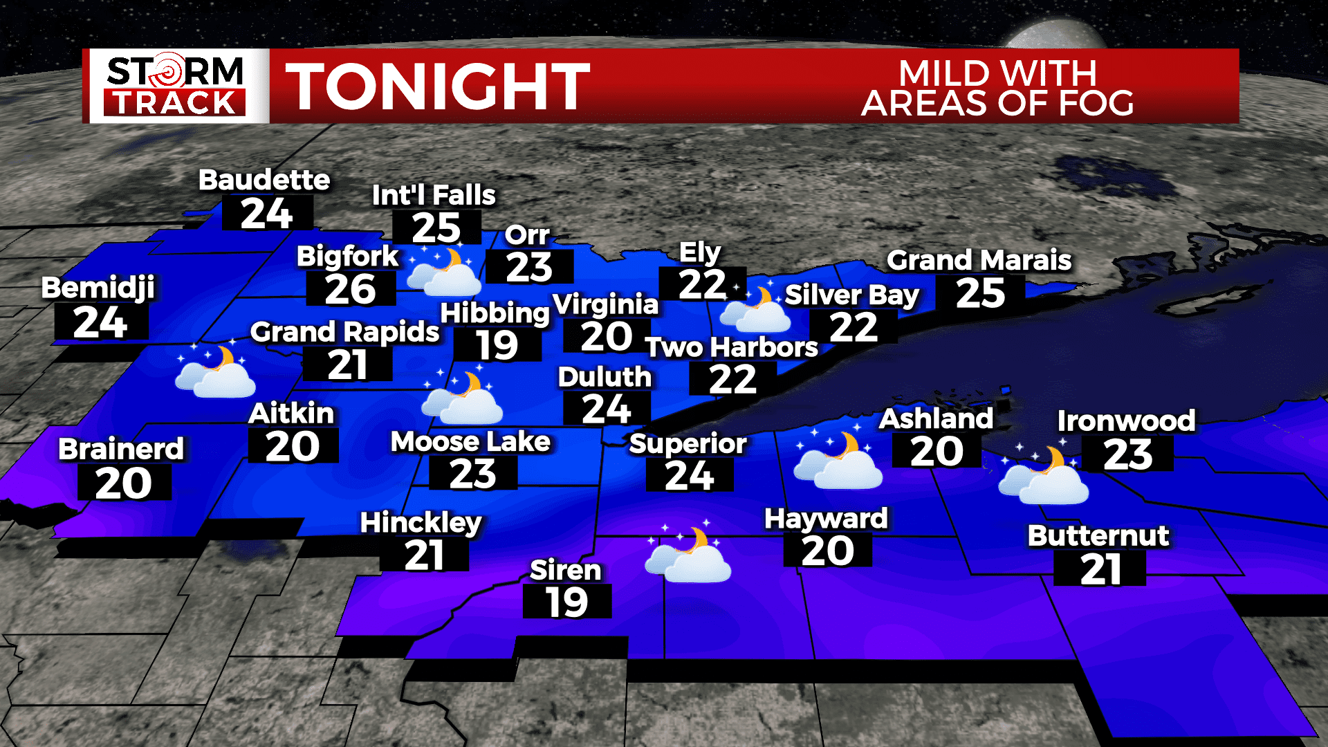
TONIGHT
Patchy fog after midnight. Otherwise, mostly cloudy, with a low around 24. Southwest wind around 5 mph becoming north after midnight.
THURSDAY
A slight chance of snow before noon, then a chance of flurries between noon and 2pm. Areas of fog before noon. Otherwise, mostly cloudy, with a high near 33. Breezy, with a north wind 5 to 10 mph increasing to 15 to 20 mph in the afternoon.
FRIDAY
Sunny, with a high near 21. Blustery, with a northwest wind 5 to 15 mph becoming southwest in the afternoon. Winds could gust as high as 20 mph.
SATURDAY
Mostly sunny, with a high near 33. Breezy, with a southwest wind 15 to 20 mph, with gusts as high as 30 mph.
SUNDAY
Mostly sunny, with a high near 35. West wind around 5 mph.
MONDAY
Partly sunny, with a high near 35. West wind 5 to 10 mph, with gusts as high as 15 mph.
TUESDAY
Partly sunny, with a high near 37. Breezy, with a southwest wind 10 to 15 mph, with gusts as high as 20 mph.