Justin Liles: Lake Effect Snow along the south shore
[anvplayer video=”5147406″ station=”998130″]
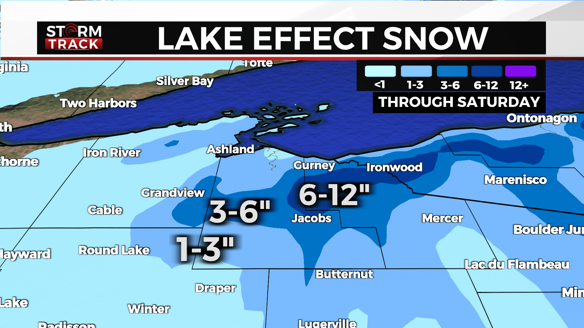
The large low responsible for our recent round of weather has pushed farther northeast. This has created northerly winds. Colder air spilling in from Canada will interact with the warmer water of Lake Superior. Lake effect snow showers will fall along the Snow Belt. Ashland, Iron and the U.P. of Michigan will see some heavier snowfall amounts. Communities in Iron County, like Hurley and Gile could see up to a foot of snowfall. Iron County is under winter storm warning until 6am Saturday.
All the other counties are under a winter weather advisory until 6am Saturday. Conditions will begin to improve here around the Northland. There will be some light snow returning with our colder air hanging around through next week. Overnight lows may get into the single digits next week.
TONIGHT
Lingering light snow, Mostly cloudy, with a low around 21. Blustery, with a north wind around 15 mph, with gusts as high as 25 mph.
SATURDAY
Partly sunny, with a high near 28. Blustery, with a north wind 10 to 15 mph, with gusts as high as 20 mph.
SUNDAY
Partly sunny, with a high near 28. North wind around 5 mph.
MONDAY
A chance of snow, mainly after noon. Mostly cloudy, with a high near 30. East wind around 5 mph.
TUESDAY
A chance of snow. Mostly cloudy, with a high near 31. East wind around 5 mph.
WEDNESDAY
A slight chance of snow. Mostly cloudy, with a high near 30. North wind 5 to 10 mph, with gusts as high as 15 mph.
THURSDAY
A slight chance of snow. Mostly cloudy, with a high near 25. West wind around 10 mph, with gusts as high as 20 mph.
FRIDAY
Mostly cloudy, with a high near 22. Breezy, with a west wind 10 to 15 mph, with gusts as high as 20 mph.