Justin Liles: More of the same until Friday
Our pattern isn’t really going to change much until the end of the week. We are still under the influence of a large low spinning in Ontario that won’t begin moving farther east until Thursday. Until then, more clouds with cooler than average conditions are likely. There is still even a chance of light rain across the arrowhead and parts of the south shore. Beginning Thursday another large low will emerge out of the Colorado Rockies and work in tandem with and area of high pressure tracking across Canada.
This will create strong gale force winds off Lake Superior by Friday. Winds will be in the 20-40 mph range with large waves on the big lake perfect for our local surfers. This area of low pressure will track south of Minnesota but spread enough moisture northward where east central Minnesota and west central Wisconsin. These areas may see 1-2” of rain with some localized heavier amounts toward Eau Claire. Showers will likely continue near the head of the lake through the weekend. We may see some sunshine by Tuesday or Wednesday next week.
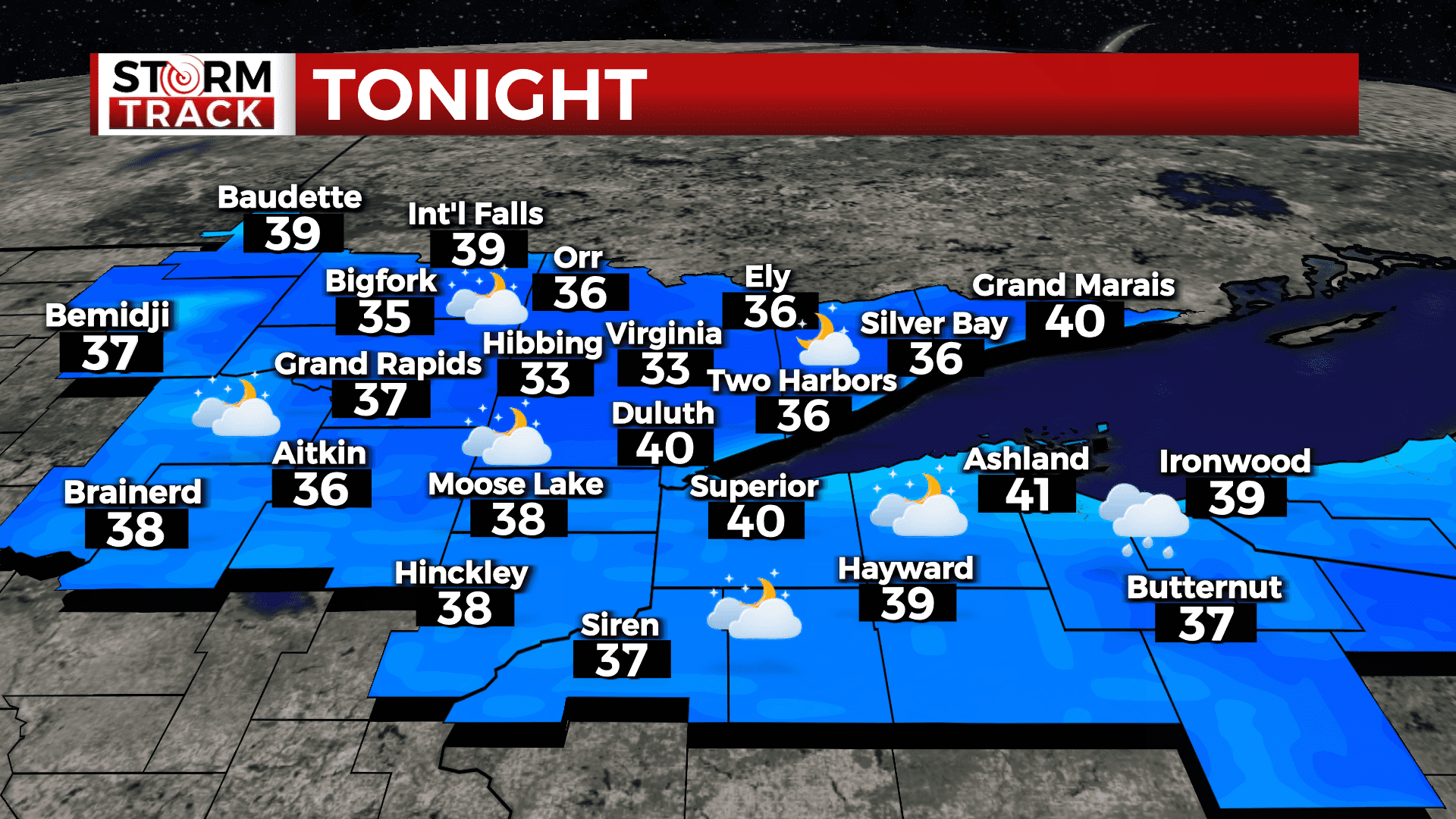
TONIGHT
A chance of sprinkles before 11pm. Mostly cloudy, with a low around 37. North wind around 5 mph becoming calm in the evening.
WEDNESDAY
Partly sunny, with a high near 50. Calm wind becoming east around 5 mph in the afternoon.
THURSDAY
Mostly cloudy, with a high near 50. Breezy, with an east wind 10 to 15 mph increasing to 15 to 20 mph in the afternoon. Winds could gust as high as 30 mph.
FRIDAY
Showers likely. Cloudy, with a high near 48. Windy, with an east wind around 30 mph, with gusts as high as 45 mph.
SATURDAY
A chance of showers. Mostly cloudy, with a high near 49. Breezy, with a north wind around 15 mph, with gusts as high as 30 mph.
SUNDAY
A slight chance of showers. Mostly cloudy, with a high near 49. North wind around 10 mph, with gusts as high as 20 mph.
MONDAY
Mostly cloudy, with a high near 49. North wind around 10 mph, with gusts as high as 15 mph.
TUESDAY
Partly sunny, with a high near 50. North wind 5 to 10 mph.