Justin Liles: More of the same!
Many of us woke up to a few isolated thunderstorms this morning and even some patchy fog. Cloud hung out early this morning and some sunshine came out this afternoon as southerly winds took over. This has allowed temperatures to climb well above average farther inland away from the lake. Cooler air by the lake and a light lake breeze is keeping shoreline communities nearly 10°-25° cooler. Tonight some thunderstorms are possible in north central Minnesota up to the International border.
A low coming out of the Colorado Rockies will stay south and it looks like to keep the majority of the weekend rain south of our viewing area. This is still a small chance as winds will again be off the lake cooling the shoreline down even more. With moisture hanging around, place around the lake may wind up being like last weekend with misty and foggy conditions. Temperatures look to rebound on Sunday with more sunshine. Just in time for Mother’s Day.
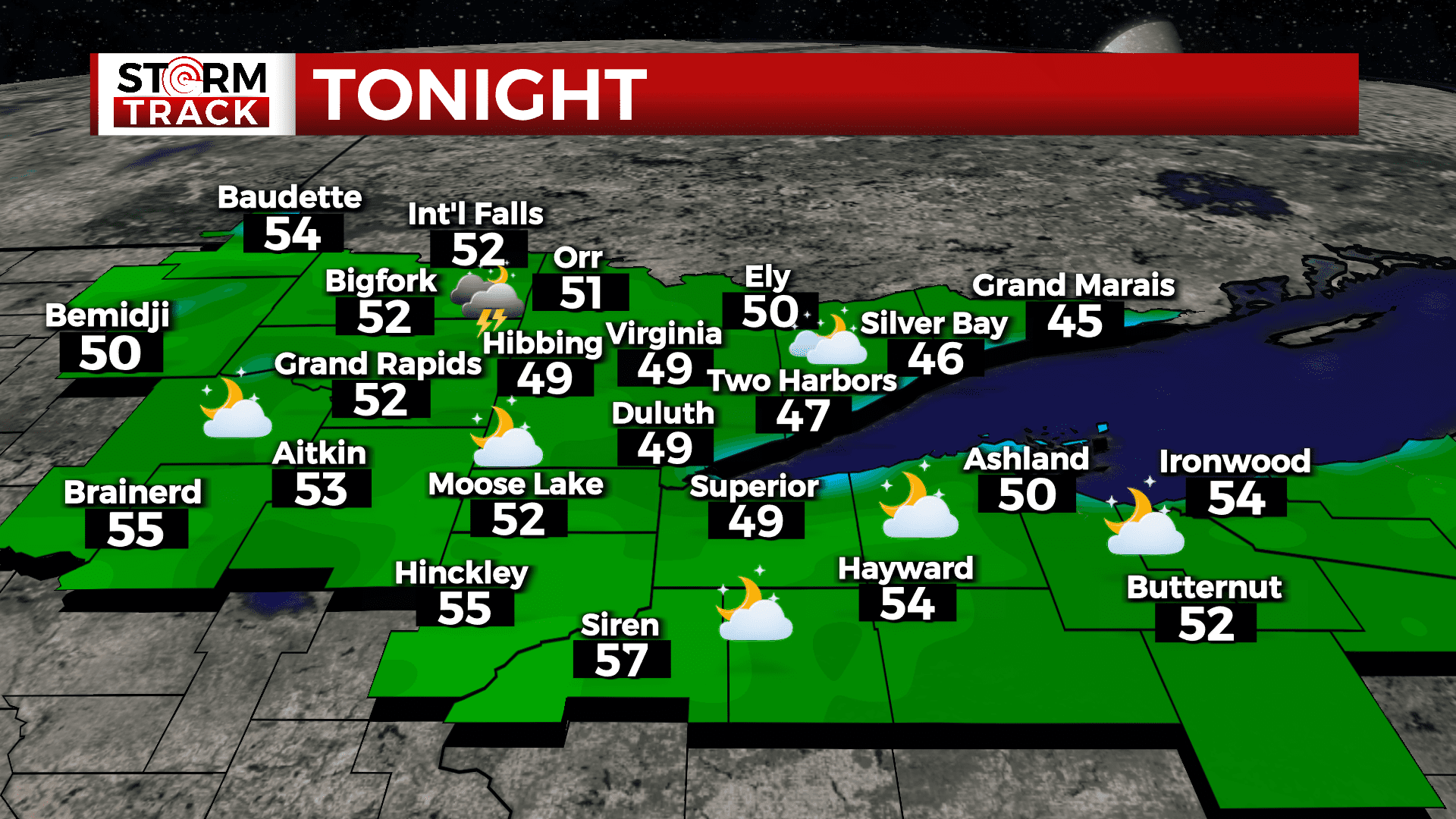
TONIGHT
Patchy fog after 2am. Otherwise, partly cloudy, with a low around 49. East wind around 5 mph becoming calm after midnight.
THURSDAY
A slight chance of showers and thunderstorms. Patchy fog before 9am. Otherwise, mostly sunny, with a high near 73. South wind around 5 mph.
FRIDAY
A chance of showers and thunderstorms. Mostly cloudy, with a high near 62. Breezy, with an east wind 10 to 20 mph, with gusts as high as 30 mph.
SATURDAY
A chance of showers. Mostly cloudy, with a high near 52. Windy, with an east wind 20 to 30 mph, with gusts as high as 45 mph.
SUNDAY
Mostly sunny, with a high near 59. Breezy, with a northeast wind around 15 mph, with gusts as high as 25 mph.
MONDAY
Sunny, with a high near 73. Breezy, with a west wind 10 to 15 mph, with gusts as high as 25 mph.
TUESDAY
Sunny, with a high near 63. Breezy, with a north wind 10 to 15 mph, with gusts as high as 20 mph.