Sabrina Ullman: Multiple chances of snow this week
[anvplayer video=”5149999″ station=”998130″]
Tonight will be mostly cloudy with overnight lows in the twenties. A calm wind will become south after midnight. Quiet weather will soon end as we have a chance of snow most days this week.
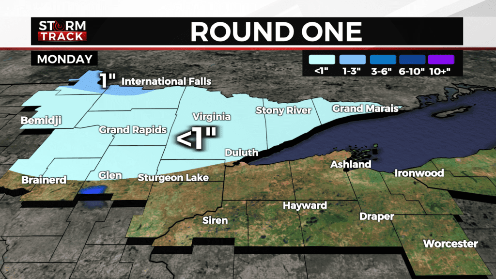
The first round will be limited to northern Minnesota. Light snow will move in Monday morning and continue on and off throughout the day. The far northern portion of Koochiching County will be the outlier for this round with 1-2 inches of accumulation. Northern Carlton and Aitkin counties and areas north will have under an inch of accumulation. The rest of the region will not have accumulating snow on Monday.
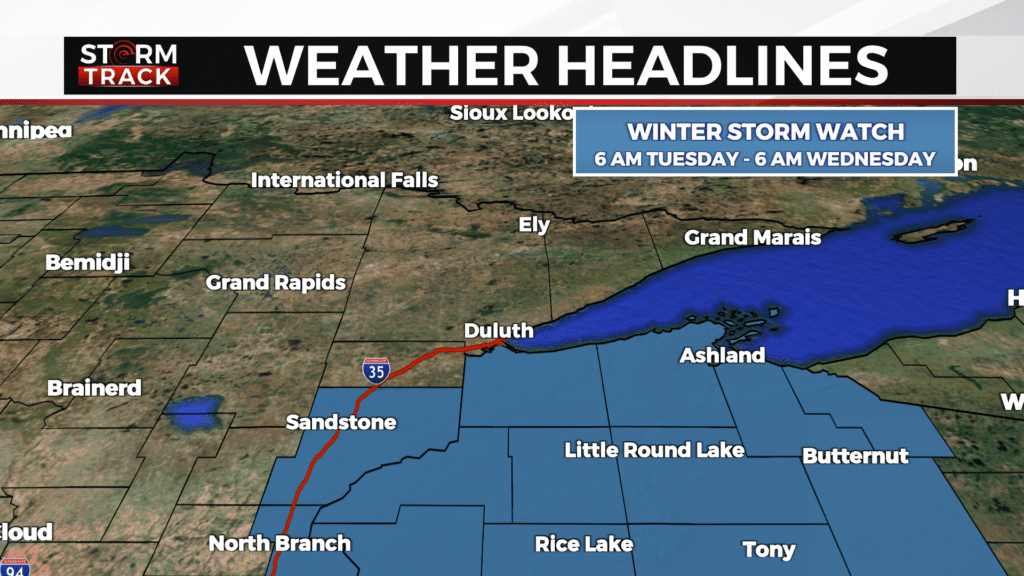
If you are missing out on snow Monday, just wait until Tuesday- round two of snow will focus on Wisconsin and the U.P. A Winter Storm Watch has been issued for northern Wisconsin, effective from 6 am Tuesday until 6 am Wednesday. Pine County is also under a Winter Storm Watch from 6 am Tuesday until 12 am Wednesday.
Forecast models have been in disagreement for Tuesday’s weather maker, with uncertainty for both timing and amounts. The morning commute will possibly be slick for the areas under a Winter Storm Watch, and the evening commute will most likely be impacted by snow.
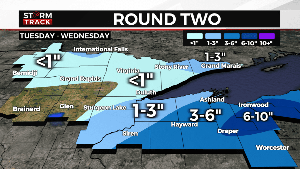
Additional lake-effect snow is possible for the Snow Belt of the South Shore on Wednesday. Later this week, there is a chance of snow Friday and another chance Sunday.
Tonight
Mostly cloudy, with a low around 22. Calm wind becoming south around 5 mph after midnight.
Monday
Quiet weather will soon end as we have a chance of snow most days this week.
A chance of snow, possibly mixing with rain after 4pm, then gradually ending. Mostly cloudy, with a high near 33. Southeast wind around 10 mph, with gusts as high as 20 mph. Chance of precipitation is 30%.
Tuesday
A 50 percent chance of snow. Cloudy, with a high near 31. Northwest wind 5 to 10 mph, with gusts as high as 15 mph. New snow accumulation of less than one inch possible.
Wednesday
Mostly cloudy, with a high near 23. Breezy, with a west wind 15 to 20 mph, with gusts as high as 30 mph.
Thursday
Partly sunny, with a high near 24. West wind 5 to 10 mph becoming southeast in the afternoon. Winds could gust as high as 15 mph.
Friday
A slight chance of snow. Mostly cloudy, with a high near 28. South wind around 10 mph becoming west in the afternoon. Winds could gust as high as 15 mph.
Saturday
Mostly sunny, with a high near 21. Blustery, with a west wind 10 to 15 mph, with gusts as high as 20 mph.
Sunday
A slight chance of snow. Partly sunny, with a high near 26. Southwest wind around 10 mph, with gusts as high as 15 mph.