Justin Liles: Snow tonight followed by bitter cold weekend!
High pressure and plenty of sunshine has given us a rather pleasant Thursday. Another clipper system will pass by tonight. Before the snow passes by overnight dropping an additional 1-3” of snow temperatures will drop this evening into the single digits. Overnight the temperatures will rise into the teens and low 20s by mid-morning Friday. After this time, temperatures will begin to fall as cold polar air returns. Winds are also expected to increase by Friday afternoon and evening.
This weekend will host the coldest air we have had since right before Christmas. Over the weekend, highs will be in slightly above or at zero. Gusty winds will create dangerous wind chills values over the weekend and spill into next week. Wind chills by Sunday AM could be into the -25° to -35° range. Wind chill warnings are likely. Temperatures will warm up slightly by the middle of next week with highs in the mid to upper single digits.
Tonight
Snow, mainly after midnight. Temperature falling to near 8 by 8pm, then rising to around 16 during the remainder of the night. Breezy, with a south wind 10 to 15 mph, with gusts as high as 25 mph.
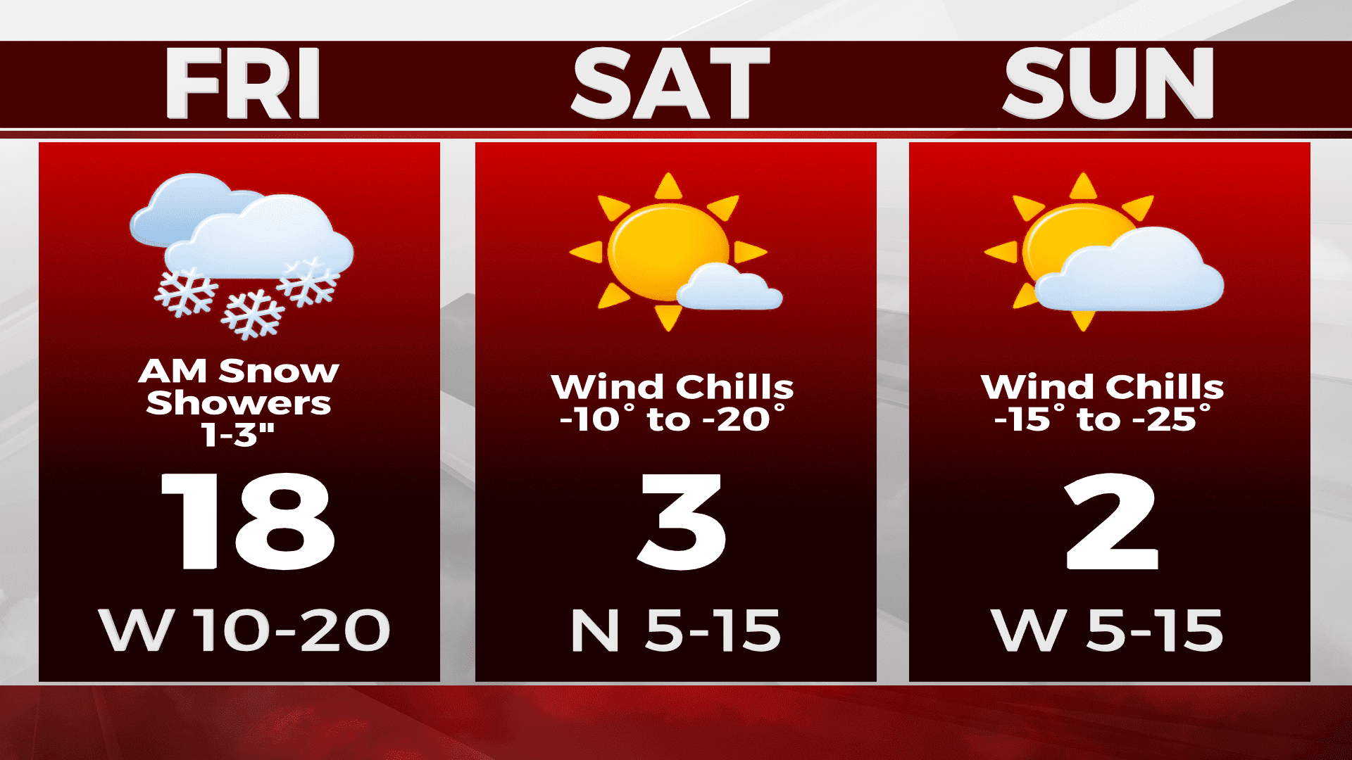
Friday
Snow likely, mainly before 9am with a temperature rising to near 21 by 9am, then falling to around 13 during the remainder of the day. Breezy, with a southwest wind 15 to 20 mph becoming northwest in the afternoon. Winds could gust as high as 35 mph.
Saturday
Mostly sunny and cold, with a high near 5. Northwest wind around 10 mph, with gusts as high as 15 mph.
Sunday
Mostly sunny and cold, with a high near 0. West wind around 10 mph, with gusts as high as 15 mph.
Monday
Mostly sunny and cold, with a high near -2. West wind around 10 mph, with gusts as high as 20 mph.
Tuesday
Mostly sunny, with a high near 6. Southwest wind around 10 mph, with gusts as high as 15 mph.
Wednesday
Partly sunny, with a high near 6. Blustery, with a west wind 10 to 15 mph, with gusts as high as 20 mph.